| [ Login ]/[ Register ] |
 Search ::
  My Data Basket ::
  Favorite/My Favorite :: Recent Changes :: :: Login Save in Data Basket ]
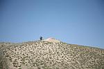
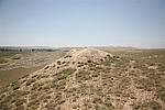
| Caption:马庄子1号烽火台 Photo Contributor:甘肃省文物局 [Open in New Window] |
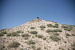
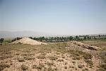
| Caption:马庄子1号烽火台 Photo Contributor:甘肃省文物局 [Open in New Window] |
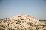
| Caption:马庄子1号烽火台 Photo Contributor:甘肃省文物局 [Open in New Window] |
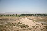
| Caption:马庄子1号烽火台 Photo Contributor:甘肃省文物局 [Open in New Window] |
| Caption:马庄子1号烽火台 Photo Contributor:甘肃省文物局 [Open in New Window] |
| Caption:马庄子1号烽火台 Photo Contributor:甘肃省文物局 [Open in New Window] |