| [ Login ]/[ Register ] |
 Search ::
  My Data Basket ::
  Favorite/My Favorite :: Recent Changes :: :: Login Save in Data Basket ]
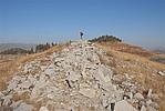
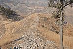
| Caption:张村长城5段 Photo Contributor:河南省文物局 [Open in New Window] |
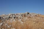
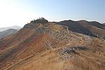
| Caption:张村长城5段 Photo Contributor:河南省文物局 [Open in New Window] |
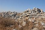
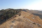
| Caption:张村长城5段 Photo Contributor:河南省文物局 [Open in New Window] |
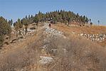
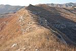
| Caption:张村长城5段 Photo Contributor:河南省文物局 [Open in New Window] |
| Caption:张村长城5段 Photo Contributor:河南省文物局 [Open in New Window] |
| Caption:张村长城5段 Photo Contributor:河南省文物局 [Open in New Window] |
| Caption:张村长城5段 Photo Contributor:河南省文物局 [Open in New Window] |
| Caption:张村长城5段 Photo Contributor:河南省文物局 [Open in New Window] |